Affiliate notice

Affiliate links may be included in posts, as on sidebar ads, for which compensation may be received.
Showing posts with label natural history. Show all posts

Saturday, July 13, 2024

A ride to Massasoit Spring -- West Springfield, Massachusetts


We salute the Town of West Springfield on its 250th anniversary with a postcard of bygone days, likely the turn of the twentieth century.  The reverse side describes the "primeval forest country" of West Springfield, about an hour from Springfield--and one can see that in a horse and carriage--or even a Model T Ford on rutted, dirt country roads such as this it could have very well taken an hour.


We don't know the name of the route in the picture, and in those days, it might not have had a formal name, but it could have been present-day Bear Hole Road or Great Plains Road.  The Massasoit Springs was a small, rustic enterprise, typical of nineteenth-century tourist sites, that provided a spot for lunch, hiking, and perhaps even the restoration of health by drinking the pure spring water.  If you weren't interested in the restaurant, perhaps the nearby cage in which a bear was kept could prompt you to make the drive.  From around the 1870s to just about the turn of the century, this was enough to bring at least a few tourists any lovely summer day.

In 1906, the area was taken over and turned into the Bearhole Reservoir, and still provides a nice place for hiking.  Any bears seen are likely not to be in cages, however.

******************

Jacqueline T. Lynch is the author of The Ames Manufacturing Company of Chicopee, Massachusetts - A Northern Factory Town's Perspective on the Civil War;   

Comedy and Tragedy on the Mountain: 70 Years of Summer Theatre on Mt. Tom, HolyokeMassachusetts;

 States of Mind: New England

A Tragic Toast to Christmas -- The Infamous Wood Alcohol Deaths of 1919 in Chicopee, Mass.; as well as books on classic films and several novels.  Her Double V Mysteries series is set in New England in the early 1950s.  

TO JOIN HER READERS' GROUP - follow this link for a free book as a thank-you for joining.

Tuesday, June 27, 2023

Westfield River -- Agawam, Massachusetts


Here are three postcard views of the Westfield River in Agawam, Massachusetts.  They are all published by the Springfield News Company and printed in Germany, as was common in the early twentieth century.  The cards all date from around 1908, and are tinted.


You'll note that on the cards the river is called the Agawam River.  The earliest English settlers to the area named it that for the Agawam tribe that lived in the area, but eventually came to be called the Westfield River.  It begins in the Berkshires and ends in the Connecticut River, forming the boundary between the towns of Agawam and West Springfield.


Despite these idyllic scenes, by the mid-twentieth century the river became terribly polluted, as many of our rivers were through industrial contaminants, but today is clean for swimming, fishing, and its locally famous Westfield River Whitewater Races.

Tuesday, May 17, 2022

Travelogue film of New England - 1940s

Have a look at a nostalgic view of New England in this travelogue film from the 1940s.  Summer in New England is something eternal.


Or watch on YouTube here.

Wednesday, July 11, 2018

A Celebration of Mt. Tom - at the MAP Gallery, Easthampton, Massachusetts


Join me in Easthampton at the MAP (Mill Arts Project) Gallery this Saturday, July 14th for a celebration of Mt. Tom in art, natural history, theatre...and ice cream.

I'll be there to meet and greet with my book on theatre on the mountain - Comedy and Tragedy on the Mountain: 70 Years of Summer Theatre on Mt. Tom, Holyoke, Massachusetts.


Join us for --

“The Mountain and Mother Nature”

A father and son exhibit of oil pastels by Ken Gagne and sculptures by Matt Gagne creating an entertaining and thought provoking experience traveling over Mt. Tom witnessing Mother Nature’s power to create, destroy and preserve the beauty of this local resource. 


Opening Reception
Saturday, July 14th 2018
5:00 pm – 8:00 pm
@
The MAP Gallery
in
 The Eastworks Building in Easthampton

Also featuring:

·              Arcadia Sanctuary

·              Jacqueline T. Lynch – local author of  “Comedy and Tragedy on the Mountain”

·              Mt. Tom Ice Cream

MAP Gallery in the Eastworks building, 116 Pleasant Street, Easthampton, Massachusetts.


Easthampton City Arts / Easthampton Cultural Council

Tuesday, May 8, 2018

Save the Date! - Celebration of Mt. Tom in art, literature, science, and ice cream! - Easthampton, Massachusetts


Save the Date

The MAP Gallery shines a spotlight

on:

“The Mountain and Mother Nature”

A father and son exhibit of oil pastels by Ken Gagne and sculptures by Matt Gagne creating an entertaining and thought provoking experience traveling over Mt. Tom witnessing Mother Nature’s power to create, destroy and preserve the beauty of this local resource. 


Opening Reception
Saturday, July 14th 2018
5:00 pm – 8:00 pm
@
The MAP Gallery
in
 The Eastworks Building in Easthampton

Also featuring:

·              Arcadia Sanctuary

·              Jacqueline T. Lynch – local author of  “Comedy and Tragedy on the Mountain”

·              Mt. Tom Ice Cream


Easthampton City Arts / Easthampton Cultural Council

Tuesday, May 17, 2016

Robert E. Barrett Fishway - Holyoke, Massachusetts

Robert E. Barret Fishway, photo by J.T. Lynch


The fish are on their way. 

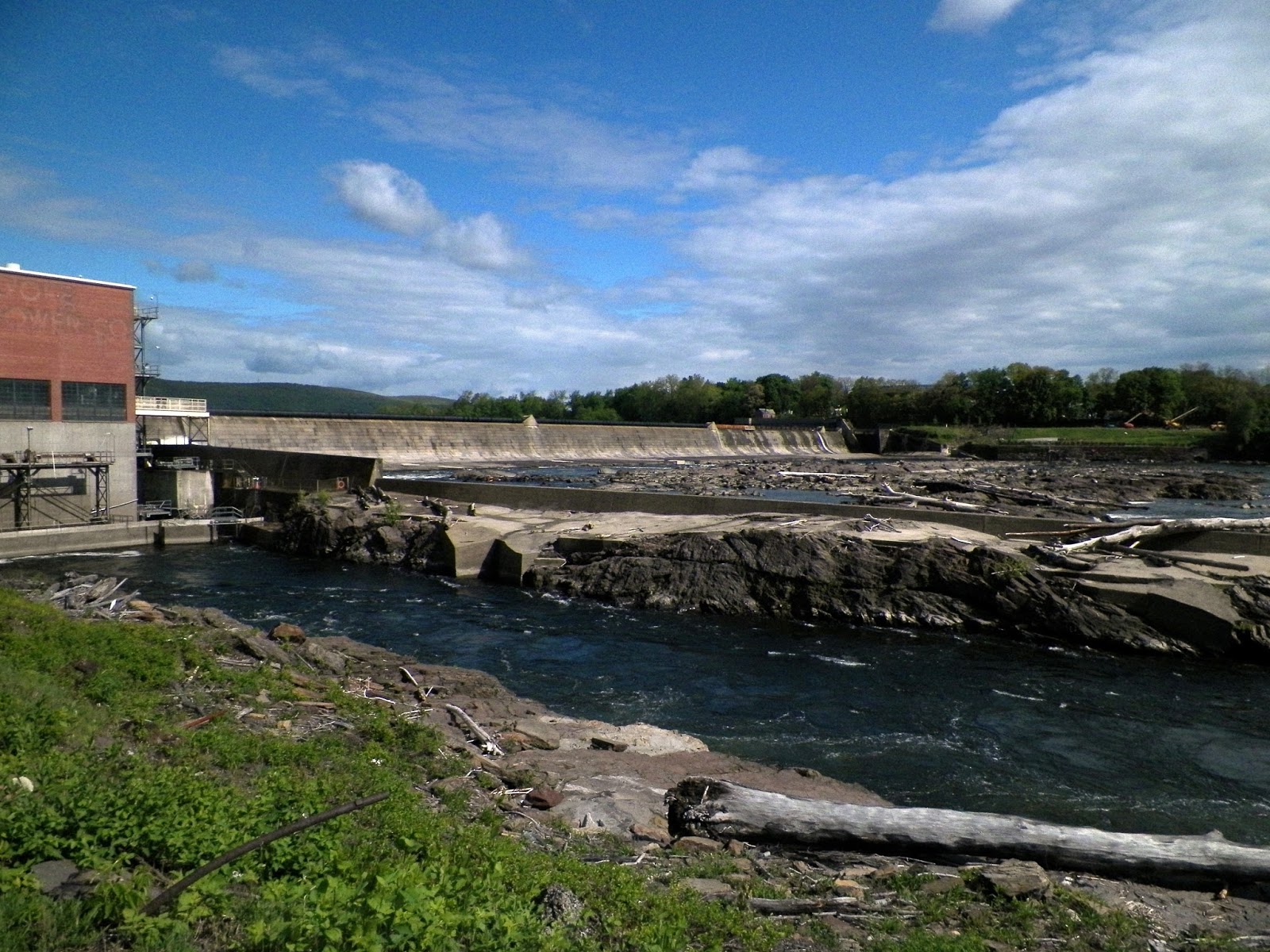
The Robert E. Barrett Fishway at the Holyoke Dam, Holyoke, Massachusetts is open to the public to observe an annual phenomenon: the spring migration of fish up the Connecticut River.


Robert E. Barret Fishway, photo by J.T. Lynch

American Shad are most predominant species, joined by Sea Lamprey, Blueback Herring, Atlantic Salmon, Shortnose Sturgeon, Striped Bass and other fish.  Most adult fish return to spawn in the rivers where they were born.


A mechanical menagerie awaits the fish at the Holyoke Dam (a sprawling granite structure across the river.  It's first version in the mid-nineteenth century was responsible for the establishing of Holyoke, a planned industrial city).  The fish are lifted in large metal bins over the dam to continue their journey north. 


Robert E. Barret Fishway, Mt. Tom in the background, photo by J.T. Lynch

But first, they scoot past the observation room where the public can have a look at the marvel.  The fish population is monitored, and the Fishway along the dam is at least one instance of industry giving nature a helping hand and providing laudable stewardship of our environment.  For more on the Robert E. Barrett Fishway, have a look at this website.

The fish are clearly appreciative.  That's their happy face.


Tuesday, September 3, 2013

A last look at summer...Mystic Aquarium

A last look at summer, with a few of the outdoor residents of the Mystic Aquarium in Mystic, Connecticut.


Tuesday, October 23, 2012

Mount Sugarloaf - Deerfield, Massachusetts


You are standing on the back of a dead giant man-eating beaver.  According to Native American legend.  Maybe so.  This is the view from Mount Sugarloaf in South Deerfield, Massachusetts.  It's only just over 650 feet high, but it's placement on a wide valley floor lends the view a strangely spectacular sense of drama.  Especially at peak foliage season.

We're looking south in the above photo; that's Mt. Tom in Holyoke on the horizon.  Here below is looking eastward.


Across the Connecticut River you can see Mt. Toby in Sunderland.  No dead giant man-eating beaver over there.  And the volanic energy that created it is long since dormant.  So, it's safe to bring a lunch and go for a hike.  Our only sense of urgency comes from missing what's left of the fleeting peak season.

Tuesday, August 2, 2011

The Connecticut River Mouth - No City, Only Sound


This is a remarkable place. This is the mouth of the Connecticut River. When Dutch navigator Adrien Block first sighted this place in 1614, we may imagine it looked similar to what it does today. The Connecticut River is rare among major rivers of the US in that no large city developed where it begins.

There’s just this.


Serene and natural, with nary a skyscraper or refinery in sight.


Now, how did that happen?


This is largely due to a geologic trait. The river carries an enormous amount of silt, as far away as from where it starts in northern New England, and sweeps it down through the hinterland, dumping it at the mouth, creating a sandbar here where it joins Long Island Sound. The silt deposits were a challenge to navigation in the early days, clogging up the works, so the speak, and so made for an inopportune spot for a metropolis.


Boston has its Charles River, and New York City its Hudson and East River. Philadelphia has its Schuylkill, and D.C. its Potomac.

The Connecticut River has instead a less auspicious, but more peaceful paradise.


The river has had its ups and downs over the years (literally, as the Algonquin word “quinetucket” means long tidal river - which it is as far as Windsor Locks near the Massachusetts border). The repository of waste from factories and human habitation left the river in dismal shape some 50 years ago. Today, through extensive cleanup and conservation measures, it has been upgraded to class B, fit for swimming and for fishing.


Here with the towns of Old Saybrook on one side and Old Lyme on the other, you can take out your boat, or sit on the dock to fish, or just stand on the banks on one of those eternal, golden summer days and let your eyes wander on what Adrien Block’s eyes saw, and agree with him that this river begs to be explored.


Tuesday, June 7, 2011

America's Stonehenge - Salem, New Hampshire

It is a mystery, still being discovered. “America’s Stonehenge” in Salem, New Hampshire is a site of caves and rock formations, and stone placements that appear to be an astronomically aligned calendar marking, and predicting, lunar and solar events. It is at least 4,000 years old, and is reckoned to probably be the oldest man-made structure in the United States.

We do not know who set these stone formations, but a variety of artifacts from a variety of eras in mankind’s timeline in North America are found here.

Stone tools, pottery, stone and bone pendants, artifacts from ancient Native Americans, and from the Colonial period. This site was also used, because of its caves and its isolation, as a hiding place on the Underground Railroad in the 19th century.

There are over 350 such megalithic sites in New England, and we are learning more about them. Prior to archeological study in the 20th century, they were only hidden spots, or known about through local legend and tales, and gossip. Strange things seen there, strange things imagined. We’ve passed through the era of myth and legend into the age of discovery, and this brings with it newfound awe and wonder for a people who lived here long ago.

The property on which this megalithic site sits is a private outdoor museum, and open to the public year-round. Have a look here at the website for more information.

Tuesday, June 1, 2010

Quechee Gorge - Vermont


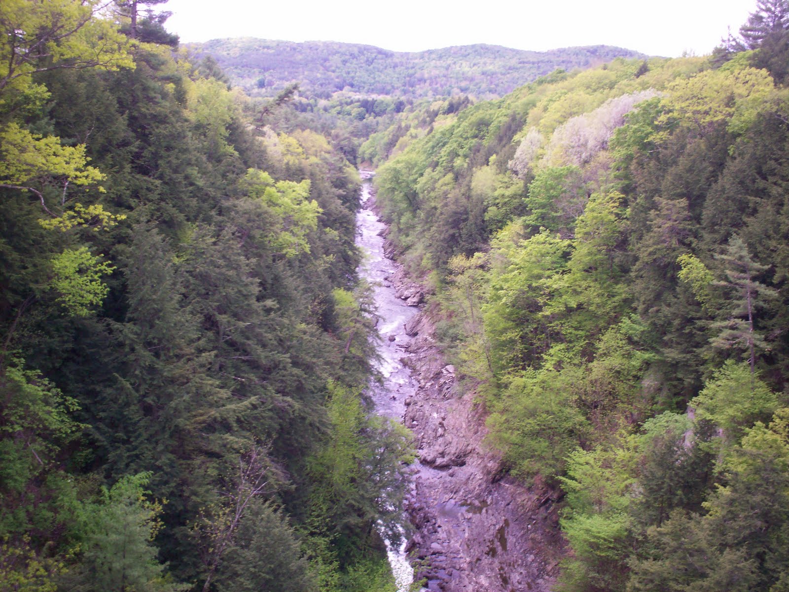
The Quechee Gorge is sometimes called Vermont’s Grand Canyon. This nickname is not so much a comparison of the Gorge to the Grand Canyon, but comparing it to the rest of New England’s glacial gouges.

New England has, for the most part, a fairly gentle landscape. Catching an eyeful of the Quechee Gorge is a jaw-dropper, I suppose because it’s sudden depth and craggy walls are not what you’d expect on your average country drive. It was formed some 13,000 years ago by glacial movement, which left a 165-foot slash in the earth, at the bottom of which lies the Ottauqhechee River, still rumbling along, oblivious to the gawkers on the bridge above.

There are trails here, and a nearby shopping plaza to catch the tourists who, driving unsuspectingly on Route 4 (that’s “root”), yank the car over to the side of the road after crossing that bridge with the surprising view. You might want to come and have a look for yourself.

For more on the Quechee Gorge, have a look at this website.

Tuesday, March 30, 2010

Valley of the Dinosaurs (or the Pioneer Valley)

In 1939, Carlton Nash of Granby, Massachusetts opened Nash Dinosaur Land on a small unearthed quarry of dinosaur tracks. Coincidentally, in that same year I believe, the Connecticut River Valley in western Massachusetts and northern Connecticut was christened The Pioneer Valley as part of an effort to promote the history and culture of this area as a tourist destination.

There has been some discussion in the last year or so to change The Pioneer Valley to The Valley of the Dinosaurs. Not without good reason.

This swath of land that opens a wide vista in the river valley from northern Connecticut up through western Mass. is the result of the scraping down of the land when the last glaciers pulled back. It left behind some of the richest farming land in the world, and some of the oldest land as well, possibly 200 million years old.

It was once the site of the pre-historic Lake Hitchcock, named for Edward Hitchcock, a renowned scientist in the early 1800s who studied astronomy as well as geology, and was one of the first to examine the dino footprints found hereabouts with something more than tolerating a nuisance, which is how the 19th century farmers thought of them.

It’s said that the first to discover, or at least the first to publicly take note of these tracks, found up and down the Valley, was a South Hadley farm boy named Pliny Moody, who plowed up a slab of footprints in 1802. Nobody knew about dinosaurs then, but they did suspect these footprints might be terribly old. Some suggested the thin, bird-like toe imprint might have been left by Noah’s raven at the time of the Flood.

Even a couple generations later, when Edward Hitchcock was giving dinosaur footprints more credence, he thought they only might have been made by ancient birds. The idea of really, really ancient reptiles long before the advent of man was still not imagined by men of science.

Fast forward to the 1930s when young Carlton Nash found strange tracks near the old Moody farm, but he knew what they were. By this time science had come of age with respect to the study of dinosaurs, and when the boy Carlton came of age, he bought the land and made himself both a roadside attraction and a mission in life.

But, there are lots of spots here and there up and down the Valley where dino tracks can be found, from rest areas off Route 5, to the very interesting Dinosaur State Park in Rocky Hill, Connecticut, which opened in 1968. This park's 200-million-year-old sandstone trackway is a Registered Natural Landmark.

And you can make your own plaster cast of some big dino foot prints.

So, if you find yourself wandering the Valley (Pioneer Valley or Valley of the Dinosaurs), step lightly. Watch for those footprints.

For more on the Dinosaur State Park, have a look at this website.   Photos in public domain from ImageMuseum website.

Friday, November 21, 2008

Mineral Springs at Stafford Springs, CT


Here are some views of Stafford Springs, Connecticut. It is a quiet community now, but long before the quiet of this autumn day, long before its rise as a manufacturing town, even before it became known for the mining of bog iron ore, this place had the interesting reputation as a resort town based on the healing properties of its mineral springs.


The young lawyer and future President John Adams traveled west from Braintree on horseback in 1771 after overwork and exhaustion left him in a precarious state of health. He wrote in his autobiography,

“I was advised to take a journey to the Stafford Springs in Connecticutt, then in as much Vogue as any mineral Springs have been since. I spent a few days in drinking the Waters and made an Excursion, through Somers and Windsor down to Hartford and the journey was of Use to me, whether Waters were or not.”

One of the first published accounts of Stafford Springs as resort location is noted in Connecticut Historical Collections by John Warner Barber, (self published, New Haven, 1836). “The Indians first made themselves acquainted with the virtues of these springs…It has been their practice, time immemorial, to resort to them in the warm season, and plant their wigwams round them. They recommended the water as an eye water; but gave their own particular reason for drinking it, that it enlivened their spirits.”

By 1899 when another account of Stafford Springs was published in The Minerals Waters of the United States and Their Therapeutic Uses by James K. Cook, A.M., M.D. (Lea Brothers, NY, 1899), we are informed that the area was known as a resort since at least 1750 for travelers seeking to restore their health. The author notes, “During the latter part of the last and for many years of the present century the place was held in high favor throughout New England and the neighboring states.” At the time of this publication, the author notes that the spring water was now being bottled.

“The water is clear and sparkling and excellent for table purposes. It has attained its greatest reputation in the treatment of blood and skin infections. It is said to be actively diuretic.” This publication lists the mineral contents: sodium chloride, potassium sulfate, sodium sulfate, sodium bicarbonate, sodium phosphate, iron peroxide, iron protoxide, alumina, lime, silicic acid, and magnesia.

By 1938 when the WPA state guidebook for Connecticut was published, the heyday of the mineral springs were long past, and we are informed only that there had been two mineral springs around the Hyde Park area from which the town got its name, and which were “in the early 19th century the center of a flourishing health resort.” The unique feature which brought native people, colonial settlers and future Presidents to visit on a health pilgrimage is reduced to a single line of type.

Stafford Springs is still as charming a town as you will find on a country drive, but there is no longer a flourishing health resort to restore you to vigor. But a quiet walk across the bridge up along Spring Street to Hyde Park and the remnants marking an old springhouse may certainly enliven your spirits.

For more information on Stafford Springs, have a look at this website.

Been there? Done that? Let us know.

Tuesday, April 29, 2008

Mt. Greylock Reservation


Here is the Veterans War Memorial Tower atop Mt. Greylock, the highest peak in Massachusetts. Photos below of Bascom Lodge, built by the Civilian Conservation Corps in the 1930s, and of the view from Mt. Greylock will have to suffice until the reservation auto road, and these structures, are once again open to the public.


Hikers are still permitted on the reservation, which spreads across six towns in Berkshire County, but the road system is under repair for 2007 and 2008. Next year, 2009, the roads to the summit will once again be open for autos, bikes, and walkers.

For more information on Mt. Greylock State Reservation, established in 1898, have a look at this website.

Been there? Done that? Stayed overnight at Bascom Lodge, or know a CCC fellow who helped build it? Let us know.

Tuesday, April 22, 2008

Rachel Carson National Wildlife Refuge


In honor of Earth Day we in New England have the good fortune to enjoy and celebrate Maine’s Rachel Carson National Wildlife Refuge.

Photos above and below show the salt marsh and forest of this stretch between Kittery and Cape Elizabeth, which also features beach dunes and coastal meadows. Established in 1966, it was named in 1969 for Rachel Carson, marine biologist and environmentalist whose landmark book “Silent Spring” forever changed our outlook on the indiscriminate use of pesticides and gave rise to the modern environmentalist movement.

The Rachel Carson National Wildlife Refuge is a valuable resource, and a truly lovely place to enjoy nature. For more information, have a look at this website.

Been there? Done that? Floated along the stream in an inner tube? Let us know.

Friday, March 14, 2008

The Flume - New Hampshire


New Hampshire’s Flume Gorge at Franconia Notch State Park takes you on a hike through granite halls, 19th century covered bridges, waterfalls and glacial boulders from the last ice age, and a wooden boardwalk that brings you up close in the gorge.

The Flume was discovered by a 93-year-old woman out fishing in 1808, so it shouldn’t be too much trouble for you to hike. As the spring comes upon us, and cabin fever drives us outdoors again, here is a great place to find that unique solace that nature offers.

For more on The Flume, have a look at this New Hampshire government website.

Been there? Done that? Brought your 93-year-old grandma? Let us know.

Tuesday, January 29, 2008

Old Man of the Mountain - New Hampshire


Above is a photo of New Hampshire’s “Old Man of the Mountain” rock formation before his loss of face. The inscription on the sign in the foreground is statesman Daniel Webster’s famous quote, “Men hang out their signs indicative of their respective trades; shoemakers hang out a gigantic shoe; jewelers a monster watch, and the dentist hangs out a gold tooth; but in the mountains of New Hampshire, God Almighty has hung out a sign to show that there He makes men.”

It is perhaps this sentiment and not the fluke of a cliff that resembles a face in profile that made the Old Man such an iconic symbol of New Hampshire, enough so that it was put on the obverse of the New Hampshire state quarter. It is also why there was such a sense of loss when nature that hath created also took away, and the symbol was gone when the rock face crumbled.

The location is in the Franconia Notch State Park. Reportedly the first mention recorded of this stone face was by American Indians in the 17th century. The area was first surveyed by Americans of European descent in the early 19th century. In the early 20th century, some eroding was already noted, and some attempts through the years to secure the rock formation were successful, until May 3, 2003, when the rock face crumbled, and the rugged image was gone.

For more information on the Old Man of the Mountain, please see this New Hampshire government website.

Been there? Done that? Got a picture? Let us know.

Tuesday, September 18, 2007

Sea Monster Champ - Lake Champlain

The above photo shows the mysterious sea monster living in Lake Champlain, commonly called “Champ.” Don’t see him? Don’t feel bad. Few people have. But he’s there. To the left. Or, maybe it’s the right. Maybe it wasn’t that day at all.

Lake Champlain, discovered by French explorer Samuel del Champlain in 1609, is sometimes called New England’s west coast. It’s a 109-mile long freshwater lake, 400 feet deep at its greatest depth, and reported, even since the 1600s, as being the home of a sea monster, long before “Nessie” in Loch Ness Scotland ever made a name for herself.

Modern-era sightings of Champ were made by passengers of ferry steamships in the 1870s, about the time of the first “Nessie” sighting in Loch Ness. Long-time “Champ” searcher and author Joseph W. Zarzynski has produced a sonar image of a creature or something with the help of Rochester Engineering Laboratories. It is hoped that one day technology will uncover this mystery of what may be a plesiosaur, living some 10,000 years beyond the age when we thought they bought the farm.


Here is the view from the ferry “Sprit of Ethan Allen” which cruises Lake Champlain, of another ferry on which passengers are also unsuccessfully seeking Champ. Oh, he’s around, though. You see him on T-shirts and souvenirs at the gift shops. One of these days, when Champ appears in the flesh, he’s going to be a millionaire with all that merchandising.

Want to go? Check out this website for one of the many cruises on lake with “Spirit of Ethan Allen III” that run through October.

Been there? Done that? Bought the Champ T-Shirt? Saw Champ? Let us know!

Now Available