Affiliate notice

Affiliate links may be included in posts, as on sidebar ads, for which compensation may be received.
Showing posts with label Hurricane of 1938. Show all posts

Tuesday, July 8, 2014

Whale Rock - Rhode Island


This is Whale Rock, whose menacing, haunting presence taunts us at the entrance to Narragansett Bay, Rhode Island.

It is all that's left of a lighthouse destroyed by the Hurricane of 1938.  In a sense, it has returned to its former self: a foreboding rock ledge, resembling a surfacing whale's back, that had been a threat to navigation until a lighthouse was established on this ledge in 1882.  There had been many shipwrecks before the light was built.

Photo National Archives

Then on September 21, 1938, the day the Hurricane of 1938 made its surprise attack (see our previous post on the storm here) , the lighthouse was destroyed.  Walter B. Eberle, the first assistant keeper on duty, was in the lighthouse during the storm.  His body was washed away and never recovered.

Today, Whale Rock is what it was, except with the addition of a lump of concrete caisson jutting up from the stubborn rock ledge.

For more on Whale Rock, have a look at this website.

Tuesday, April 23, 2013

Growing Up in Prescott - A "Lost Town" of Quabbin


Quabbin Reservoir from the Prescott Peninsula, 1991, photo by J.T. Lynch
 
This coming Saturday, April 27th, a celebration, a commemoration, and a reenactment of sorts of the final Farewell Ball of the towns demolished to make way for the Quabbin Reservoir will be held in Ware, Massachusetts. (For more information, see this Friends of Quabbin, Inc. site.)

The dismantling of four entire towns in the 1930s—Prescott, Enfield, Dana, and Greenwich—to construct the Quabbin Reservoir in Central Massachusetts is a remarkable feat of engineering, a sorrowful exodus, and a compelling historical event that surfaces from time to time in anniversaries.  The last generation of children growing up during this strange era have mostly left us, and so the archival resources of the Friends of Quabbin in Ware and the Swift River ValleyHistorical Society in North New Salem are ever more important.

Many years ago, I was privileged to research and write about these events for a western Massachusetts monthly historical magazine, called Chickuppy & Friends.  One of that last generation I interviewed was a lovely lady named Eleanor Griswold Schmidt.  She gave many interviews to local press, and was eager to talk about the experiences of the Swift River Valley residents forced to give up their homes.  I sensed she felt that passing the story along was duty she paid to her parents and their former town of Prescott, to not let it be forgotten.

Mrs. Schmidt is no longer with us, except in her words.  What follows is the article that resulted from one of our talks together, originally published in May 1986.  She paints a picture of a town and a lifestyle in the details of everyday life.

****


Prescott was a farming community.  There were a few stores and a couple churches, but mostly it was farm after farm with miles between neighbors.  Eleanor Griswold Schmidt and her five brothers and sisters grew up on their Prescott farm in the 1920s when Prescott was “folded up and no longer a town.”  The town met its official demise in 1938, but due to the weight of that forced change, most of the population evacuated during the 1920s.  The Metropolitan District Water Supply Commission (MDWSC), which managed the Quabbin Reservoir project, helped to support a town government in Prescott in 1926 just to keep the town offices officially open until the town's scheduled demise on April 27, 1938.

The children of remaining families, like the Griswolds, lived through the change in their community and observed the death of their town.  The “death” was the loss of its people.

Her parents, Mr. and Mrs. Griswold, came to Prescott as teenagers in the late 1800s.  Mr. Griswold’s family was from Huntington.  Mrs. Griswold’s family, the Smiths, came from their old farm around the present-day site of Bondi’s Island in Agawam, Massachusetts.  Algie Griswold and Olive Smith married in 1911, and all their six children were delivered by one of the more well-known men in the Swift River Valley, Dr. Willard Segur, in Mary Lane Hospital in Ware.

Eleanor was the eldest, followed by Eddie, Lyman, Doris, Beatrice, and Frances, the last born in 1924.  The Griswolds’ entire living was made from the farm, from the milk of their dairy cows, which they brought to the train in Enfield, to be taken to Springfield.  Their refrigeration was from the ice harvested from the local ponds in winter.  The boys and girls in the family had chores divided among them, and helped out in every part of running the farm.  While the boys were busy in the barn, there was housework for the sisters, and the tending of the ducks, pigs, and chickens.  They brought eggs to the A.H. Phillips store in Enfield to turn them in for groceries. 

The store and post office in Prescott had gone by the late twenties.  There were fewer telephones by the late twenties, and there had never been any electricity or running water where the Griswolds lived.  But they lived self-sufficiently as farm families can, wanting little, needing less.

According to Eleanor Griswold Schmidt, “The surplus from a family of eight was what the public got a chance to buy.”  Haskell’s store in Enfield had clothing and notions.  They bought from the Charles Williams store catalogue and the Montgomery Ward catalogue for clothing. 

There were Katzenjammer Kids funnies plastered on the insides of the outhouse.  Hans und Fritz had truly been everywhere.

They made cakes and pies, ice cream to sell from a stand in front of a church at the four corners.  On summer weekends, people came from all directions: Enfield, Pelham, and Greenwich, and bought homemade ice cream for a nickel from the Griswold kids: chocolate, vanilla, strawberry (if they were in season).

Most days, breakfast was home fries, eggs, bread and butter.  Mrs. Griswold made a kind of coffee drink for the kids ground out of bread crusts that were browned in the oven.  There was hot cereal in the wintertime for the two-mile walk to school.  The kids got up at six o’clock, did the milking, fed the cows, chickens, all the animals.  The cows were driven down to water.  The barn was a warm place, even in the winter, from the hay stored and the body heat of the animals.  The brothers and sisters came back to the breakfast table to eat in shifts whenever they were done.  There was strong-smelling Fels-Naptha soap bar with its mottled orange wrapper for the dishes.  A pump at the sink, the water was heated on the stove.

“It’s such a good thing today, electricity,” said Mrs. Schmidt.  The whites were boiled on the stove as well in a copper kettle.  Clothes were also washed in a mechanical washing machine with a handle to turn.  “A hundred and twenty times, and then you can play.”  This was done outside.

The clothes were put through the wringer and hung, the whole sunny yard filled with flapping laundry.

School started at nine a.m.  The Griswold children were taught by Miss Marion Kelly at Prescott School No. 3, a one-room schoolhouse.  The children of each grade were taught together at the primary level.  After that, it was high school in Belchertown.  There were under thirty children in the school at the time the Griswold children attended, two or three to a grade, as it happened, and Miss Kelly managed them all.  It was a system that encouraged and relied upon the children’s independence. 

“You had your work to do.  If you didn’t get it done, there was nobody but to blame but yourself,” Mrs. Schmidt said.

The kids respected and liked Miss Kelly, and there was no nonsense, and also no books to take home.  All practice work was done at school.  With chickens and cows, there was already too much to do at home.  It was in the schoolroom that they practiced their precise Palmer handwriting and memorized multiplication tables, backwards and forwards, and backwards again.

“I think the little ones were the ones who made out the best, because they could hear everything that was going on, so they could come along a little bit faster,” said Mrs. Schmidt.  “You had to kind of learn on your own, I guess.  Nobody ever sat beside you or helped you in any way.”
Prescott Hill No. 3, date unknown, photographer unknown.  Image Museum website.

A visiting music teacher came at intervals as well.  Report card results were their own reward.  Sometimes.  Mrs. Barbara Fuller and her husband, Clarence, ran the store and post office in that part of Prescott, and she promised chocolate drops to the kids if they got an “A” in music.  Mrs. Fuller also gave piano lessons.  Mrs. Schmidt remembers the time she missed getting an “A”, and Mrs. Fuller said, “’What’s wrong with the spelling, Eleanor?  You can do better than that.  Get an “A” in spelling and...’ She didn’t discriminate,” Mrs. Schmidt said, “She knew I wasn’t trying and this was her way of snagging me, and it worked.”  She took piano lessons from Mrs. Fuller herself and found a great friend in her.  “She had a box of jewelry that was her mother’s, and she let me put them on, and then she gave me a very pretty thing of her own.  It was a locket with her picture on it.” 

The Fullers closed their store and post office, and joined the exodus in 1928.

Lunch at school was a covered dinner pail with jelly sandwiches, or cheese, or peanut butter.  Across the road from the school was a well and a tin dipper.  Children brought a cup from home, or just all drank from the same dipper.  Besides the half-hour recess, there was a short break in the morning and afternoon, enough time for an apple for a snack.

There were two entrances at the school: one for the boys and one for the girls, just as there were two separate outhouses for the boys and girls.  Classes may have been more or less informal in a one-room school, but rules and customs were strictly observed.

“She was a lovely person,” Mrs. Schmidt said of their teacher, Miss Kelly.  “There were no lickings.  I never saw any kid get hit.  My brother had to go to the entryway once (where punishments were administered), and I never knew what happened to him, but you’re mortified knowing your brother’s out there.  He said he didn’t do it, and he told me himself only a few years ago, he said, ‘You know what really happened?  She whacked with a pointer a coat so it made a  whack, whack, whack noise, and Miss Kelly said, ‘I wan’cha to holler a bit, too.’  She never did anything to him, but everybody thought, ‘Oh, is she murdering him!’”

Miss Marion Kelly left too, and according to Mrs. Schmidt was later a teacher in Wilbraham, eventually to become a principal there.  She is remembered by her former students as well as for the Christmases she gave them.  The kids received candy, an orange, a pencil box and pencils with the child’s name on them, a calendar with a picture of that child’s grade classmates on it.  Even a classroom tree.  It was, “a Christmas that a lot of the kids didn’t have at home.”  It all came out of her own pocket and her heart.  Like the children, she walked to school herself on the empty, dusty roads in Prescott.
The student body, teacher, and visiting canine friend of Prescott Hill School No. 3.  Date unknown, but probably long before the Griswold kids attended.  Image Museum website.

Besides Miss Kelly and the visiting music/singing teacher, the superintendent of schools visited, perhaps twice a year, and the children had to be on their best behavior.

“He was the President of the United States as far as we were concerned,” Mrs. Schmidt said of the strange, austere figure.  “Somehow, you felt scared to be in his presence.”

Her church, the Prescott Congregational, also served as a schoolhouse.  This building, too, joined the exodus and now stands as the Skinner Museum in South Hadley.  There were Sunday School activities as well, bibles won for scripture memorized, and plays. 

The children came home to bread and vegetables for supper, perhaps a dessert called junket, a kind of custard made of sweet milk.  Sunday dinner was the big meal of the week, with corned beef, dried beef or codfish.  Their chickens were for laying eggs, not for eating, although one may have found its way into a soup from time to time, or for Thanksgiving and Christmas. 

They would often take Sunday dinner at their Grandmother Griswold’s after church.  They also went there for Christmas.  A hemlock tree was there, strung with popcorn and cranberries, but no candles.  Prescott was rural, with no fire department, so candles were too dangerous on a tree.  There were dolls for the girls one year, and under their Christmas tree, simple toys, and perhaps a hat or boots, or leggings for the winter walk to school, or mittens cut out from an old coat. 

The Griswold children hung their stockings.  Depression Christmases.  If they found coal in their stockings, it wasn’t because Santa Claus was mad at them; it was because their parents had nothing else.  “That was just a symbol to us that our parents were sorry,” said Mrs. Schmidt.  “Those were times that there were tears that we never saw, but we knew.”

Other than the occasional Grange doings, there were no town gatherings in the dwindling town, not beyond the Memorial Day ceremony at the cemetery where children from the schools read their poems.  There were family celebrations, though.  Uncles who shot off fireworks on the Fourth of July.

The Griswold children played around the ponds, fished, hunted for lady’s slippers in the summer woods.  Some of their neighbors left.  Other farms were occupied by renters in the summer who rented land back from the MDWSC, which had purchased it from the owners.  But there were six Griswold kids and they didn’t need to walk to a neighbor’s home miles away only to have to return for supper.  They had themselves, their parents, their farm.  The older ones looked after the younger. 

“There was a lot of responsibility, a lot, and I’m glad, because you knew all your life you were responsible for others as well as yourself.”

About 1930, Mr. Griswold bought a Model T Ford and terrorized his children with his lack of driving skills.  “We kids never liked to ride with him because he never knew how to drive.  He was all right with horses, but couldn’t do much of anything with a Model T,” Mrs. Schmidt said.

Later in her teens, Eleanor left home to work in a Greenwich store and board with a family there.  She earned $7 a week at SR King’s store, plus room and board.  It was general store that sold everything from meat to boots, and dry goods, cookies in bulk, National Biscuit’s, “Raspberry Ripples.”  Many customers bought on credit in these Depression days.  Many had already moved out of Greenwich and left the Valley for good.

The main populace there at the time were the “woodpeckers,” the men who were brought in to cut trees and clear brush, the men who were building Quabbin Reservoir.

“I loved it because all the woodpeckers and workers were there,” said Mrs. Schmidt, whose nickname among them was “Peaches,” one of the few single girls for miles.  Most of the men were married, but they joked with her and flirted, and Mrs. Schmidt said it wasn’t a bad place to be when you’re the only single girl for miles.

After 1937, she went to work for another store in North Amherst, $10 a week, six days a week.  There was an ice cream and soda bar there, and a lunch counter where she made sandwich lunches for the teachers.  Back at the Griswold farm in Prescott, the last of their neighbors left in 1933.  There was no store telephone after ’33.  Her family was isolated in Prescott, and felt the brunt of that isolation during the Hurricane of 1938.  Eleanor’s fiancĂ©, Edward Schmidt, walked ten miles through debris to reach the Griswold farm and back to Eleanor in North Amherst to report on their safety.

Mr. Griswold had died in 1937 of a ruptured appendix.  Dr. Segur couldn’t help.  To the end, Mr. Griswold never wanted his land to be sold.  Ultimately, he didn’t have to witness it when his family sold and moved to Amherst. 

Eleanor became Mrs. Edward Schmidt in 1939.

“Mine is a slanted, different childhood,” Mrs. Schmidt said of the experience growing up in a dying town that they knew, even as young children, was dying.  There was a struggle against it in Prescott as there were in the other towns, but it was also a nation in Depression.  They were going to lose their homes.  No matter what they did, they were going to lose their homes.

Much of Prescott was not inundated by the reservoir, and instead, became a wildlife sanctuary.  On the old Griswold farm, an open hayfield is now wooded.  Mrs. Schmidt has obtained permission a few times to return to the spot.

“Nothing is familiar,” she said.  The farming community has returned to the wilderness.
The Prescott Peninsula, 1991, photo by J. T. Lynch


***

My novel, Beside theStill Waters, is a fictional account of the people in the “Quabbin towns.”  I’ll be posting more about that in weeks to come in this, the 75th anniversary of the disincorporation of Dana, Enfield, Greenwich, and Prescott, Massachusetts in April, 1938.


Tuesday, October 9, 2012

West Cornwall Covered Bridge - Connecticut


The iconic red bridge has known its lonely moments, but this is not one of them. On a spanking fresh fall day, the West Cornwall Covered Bridge in West Cornwall, Connecticut is likely to be the scene of converging leaf-peepers with cameras.

Open to vehicular traffic, a minor traffic jam might occur when someone takes a little extra time to get that perfect shot.


Bridges were placed on this spot over the Housatonic River as early as the 1760s, but floods and ice swept them away. This present bridge was reckoned to have been built about 1864. It had been gray colored until 1957, when it was first painted red and took on the image of typical New England tourist brochure. According to the ConnecticutHistory.org site mentioned below, the producers of the 1967 film, “Valley of the Dolls” used a shot of the bridge at the opening of the movie to represent an idyllic New England town.


Fame didn’t go to the bridge’s head. It’s still willing to mingle among the little people, it’s adoring fans, who cluster under its roof timbers and line up along the banks of the Housatonic as they set up for that perfect photo.


A covered bridge is a precarious structure. This one has been threatened (what hasn’t?) by the Hurricane of 1938, the 1955 flood, and a 1961 ice jam. An effort by the community in 1968 to save and preserve the bridge received the help of the Connecticut Department of Transportation to raise the bridge and insert a steel support under the roadway. Today it is listed on the National Register of Historic Places.

If you happen to be meandering through western Connecticut, have a look at West Cornwall’s lovely bridge. If it’s a sunny, leaf-peeping weekend and others have gotten there first, don’t mind. Get out your camera. You’ll get your turn. In the meantime, listen to the splash of the Housatonic on the stones below, and breathe the fresh air. It’s a good spot for a rest.


For more on the West Cornwall Covered Bridge, have a look at this West Cornwall Historical Society site, and this site for ConnecticutHistory.org.

Tuesday, September 18, 2012

Hurricane of 1938 Marker - Wickford, Rhode Island

This Friday, September 21st marks another anniversary of the Hurricane of 1938, which we covered here in this three-part post. We don't hear too much about that monster storm anymore as the generation that experienced it firsthand is diminishing among our ranks.  But here and there the great storm left calling cards that remain.  The generation that experienced it wanted it remembered, too.

Here on the brick facade of a charming bookstore on the corner of Main and Brown streets in Wickford, Rhode Island is a plaque.


To measure by, lest we forget.

Tuesday, August 7, 2012

Plum Beach Lighthouse - Rhode Island


Today is National Lighthouse Day. We mark the establishment of America’s lighthouses through act of Congress in 1789 on this day. The lighthouse above is called the Plum Beach Lighthouse, and represents how both a love of lighthouse history and future preservation can come together.

It stands in Narragansett Bay, Rhode Island. The Jamestown Verrazano Bridge looms over it, though when the 53-foot lighthouse was constructed in 1899, there was no bridge here, and a need for aid to navigation around Plum Beach Shoal.

The Hurricane of 1938 wreaked havoc on the little light, and trapped the keeper and his assistant, who reportedly tied themselves down to the apparatus that turned the beacon. They made it through the storm, but the Plum Beach Lighthouse was put out commission only a couple years later, not through storm damage, but because of the first Jamestown Bridge that opened in 1940. The lighthouse was decommissioned in 1941.


For several decades it sat rusting, in a kind of legal limbo, until the Friends of Plum Beach Lighthouse were formed to restore and preserve it. The incredible task of restoring this lighthouse is detailed in the Friends of Plum Beach Lighthouse website here.

The lighthouse is now restored and the light, now a solar-powered beacon, was re-lit in December 2003.

For more on the history of Plum Beach Lighthouse, have a look here. For more on National Lighthouse Day, have a look at this website.

Friday, May 14, 2010

Southeast Lighthouse - Block Island


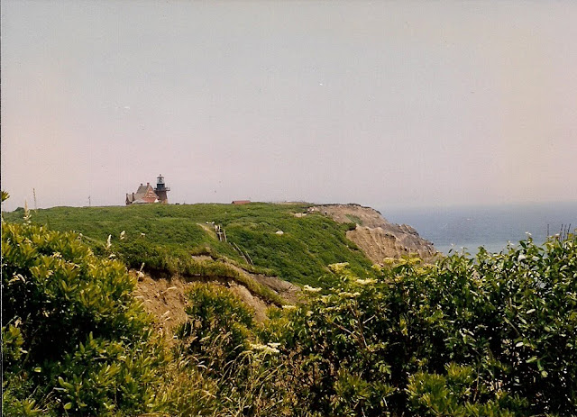
Now that summer is fast on our heels, we’ll return to a few lighthouse posts in the next few months. Standing sentinel on Mohegan Bluffs is the Southeast Light of Block Island. This Victorian Gothic structure was built in 1874.

The Hurricane of 1938 wreaked terrific damage on the lighthouse, as it did on pretty much everything else in the southern New England states, but even this mighty storm was nothing compared to the simple, slow ravages of time on the seacoast, when the ocean reclaims the land.

In August 1993, this building was moved back about 250 feet to save it from erosion. At that time, it had stood only 55 feet away from falling into the ocean, when once it had stood about 300 feet away from the bluff. The Block Island Southeast Lighthouse Foundation was responsible for raising the funds to have it moved.

The light had been deactivated in 1990, but the restored lighthouse was relit in August 1994. It is now a National Historic Landmark, and the renovations continue. There is a small museum here, and tours of the light.

For more information and history of the Southeast Light on Block Island, have a look at this website, and also this one.

Tuesday, November 4, 2008

Palmer's Washington Elm


On this voting day, no views of polling booths or campaign signs. Instead, the photo of an elm tree taken in Palmer, Massachusetts in 1906. Locals called it the Washington Elm.

It was part of local lore that George Washington rested under this tree while traveling the Boston Post Road, now Route 20. The magnificent old tree toppled in the Hurricane of 1938 (see blog post here).

The photo, part of the Palmer Public Library collection, was taken by D. L. Bodfish of Palmer. George Washington was a man who became an icon. The tree became folklore. The democracy represented by the icon and the folklore outlasted both.

Friday, September 26, 2008

Hurricane of 1938 - Part 3

In Hartford, there were 4,000 homeless, (30) but by the weekend, cleanup was advancing and the railroads would announce some new schedules on Sunday. (31) The Army Corps of Engineers estimated that 250 million trees were lost in the region. (32) Five years later, the U.S. Forest Service in Williantic, Connecticut announced that the last of the hurricane timber in the state was finally salvaged, and so closed its office there. (33)

The trees were a heartfelt loss. Recollections of the tumbling trees bowled over by an unseen hand is foremost in people’s memories. The terrific wind lasted only for about four hours, but in that time the landscape was forever changed. Trees which had stood since the Revolution were toppled. The dunes along the beaches would build up again, but it would take fifty years, it was said at the time, for the trees to return to their former glory.

It has since been 70 years, and we know now that those scenes are gone for good. An editorial in the New York Times by Elmer Davis noted, “The first thing almost everyone said was that it didn’t matter about the houses, they could be rebuilt; but the trees…would never be restored in the lifetime of anyone now living here.” (34)

The city of Springfield, Massachusetts lost 16,000 shade trees. The lumber pulled from the city streets was piled up at the City Infirmary, most of which was distributed to welfare recipients to use as fuel. The price of wood then was $6.50 per cord. (35)

About a week after the storm, First Lady Mrs. Eleanor Roosevelt arrived in Springfield to deliver an address at the Municipal Auditorium on behalf of the Springfield Teacher’s Club to help raise money for the Child Welfare Fund.

Mayor Roger L. Putnam and two of the committee met her in Harford, Connecticut to personally escort her because of the “precarious travel conditions.”(36) Her address on the “Problems of Youth” was standing-room only. In his welcoming speech, Mayor Putnam asked Mrs. Roosevelt to convey their gratitude to the President for so swiftly sending out Federal aid, and help from the CCC, the WPA among other agencies to help in the crisis. Reportedly, Mrs. Roosevelt phoned her husband and kept him abreast of the conditions she witnessed in New England. Evidently, Eleanor’s efficiency could rival FEMA’s. (37)

The high death toll, nearly 700 lives lost, was the result of the storm crossing with no warning what was, and still is, a densely populated area. One note of good fortune was that though some 369 cottages were destroyed on Misquamicut Beach, Rhode Island, the death toll there was held at 41, as the New England beachfront properties were populated mainly in the summer months, and in late September, had already been boarded up and closed. (38)

The injured numbered over 1,700. Homes completely destroyed amounted to nearly 9,000, with damaged to nearly 73,000. The total economic loss was set at $3 million 1938 dollars. (39) Over 93,000 families shared in this loss, and over 15,000 families required, or at least sought, assistance. Many delayed requesting aid “with typical New England reticence” until they had exhausted resources of their own. (40)

Some thirty-two immunization centers were set up to curtail the spread of illness from cholera and other such diseases when water and sanitation systems are impaired.(41)

Of the New England states, according to the Red Cross, Massachusetts led in the most storm damage and injuries, though Rhode Island suffered the highest death toll. (42)

More relief funds were required in Massachusetts than in the other states, and western Massachusetts was harder hit than the Boston area because the storm precariously traveled up the Connecticut River valley. Fund raising was slow, although there were contributions from sympathetic donors through the country, including a group of California hoboes who collected $2.10 specifically for the City of Springfield.(43)

Hurricanes, as it happens, are not new to New England. Governor William Bradford, Massachusetts Bay Colony leader, recorded a severe tropical storm in August 1635, and there was also the Great September Gale of 1815. However, the people who suffered those storms did not rely on man-made infrastructure.

In 1938, almost all telephone and telegraph communications were crippled between Boston and New York. Train and bus service was hampered, and air travel, rarely used, enjoyed a brief if desperate deluge by stranded business people. The use of short-wave radio helped during the complete loss of communications in many places. The tracks of the New York, New Haven, and Hartford Railroad were blocked for two weeks. (44)

About 240 communities, it was estimated, were virtually isolated. Trains, steamships, telegraph. It sounds rather archaic today, but New England was heavily populated and therefore was one of the most sophisticated in terms of communications and city infrastructure.

One should not attempt to draw too many parallels between Hurricane Katrina and the New England Hurricane of 1938. They were both unique in the breadth of the damage they brought to the lives and the cultures of each stricken area, and both inevitably to become part of the folklore of the region.

The lesson appears to be that if it happened once, it can happen again. New England has had a span of several years, even decades to recover after each hurricane since the 1938 storm. New Orleans may not be so lucky, as evidenced by Hurricane Gustav. The area around Houston and Galveston, Texas are currently grappling with the aftermath of Hurricane Ike. If the warming trend of the ocean continues, perhaps New England may not be so lucky, either.

This concluces our three-part series on the Hurricane of 1938.

________________

Footnotes for this series:

1) Howard Koch. “War of the Worlds” radio play. (NY: Nostalgia Lane, 1982).
2) William Elliott Minsinger, M.D., ed. “The 1938 Hurricane.” (East Milton, MA: Blue Hill Observatory, 1988), p. 9
3) Federal Writers Project. New England Hurricane. (Boston: Hale, Cushman, & Flint, 1938), p. 7.
4) Everett S. Allen. A Wind to Shake the World. (Boston: Little, Brown & Co., 1976), pp. 347-348.
5) Providence Journal Company. The Great Hurricane and Tidal Wave - Rhode Island. (Providence: September 1938), p.1.
6) ibid.
7) New York Times. September 3, 1938, p. F-9.
8) Springfield Daily News. September 6, 1938, p. 5.
9) American Red Cross. New York-New England Hurricane and Floods - 1938 - Official Report of Relief Operations. (Washington: October, 1939), p. 1.
10) New York Times. September 20, 1938, p. 1.
11) Boston Daily Globe. September 20, 1938, p. 2.
12) Boston Evening Globe. September 20, 1938, p. 9.
13) New York Times. September 21, 1938, p.24L.
14) p. 51L.
15) Springfield Daily News. September 21, 1938, p. 1.
16) P. 2.
17) Ibid.
18) Photo Record - Hurricane and Flood - New England’s Greatest Disaster. (NY: New England Historical Events Assoc., Inc., 1938), p. 1.
19)Aubrey Parkman. Army Engineers in New England. (Waltham, Mass.: US Army Corps of Engineers, New England Division, 1978), p. 179.
20)Hartford Courant. September 22, 1938, p. 1.
21)Providence Journal Company, p. 1.
22)Newsweek. October 3, 1938, p. 13.
23) BDG. September 22, 1938, p. 9.
24) Newsweek. October 3, 1938, p. 13.
25) SDN. August 18, 1958.
26) SDN. September 22, 1938, p. 2.
27) P. 7.
28) American Red Cross, p. 5.
29) Federal Writers Project. New England Hurricane, p. 219.
30) Hartford Times, September 24, 1938, p. 1.
31) Boston Evening Globe. September 24, p. 1.
32) Army Corps of Engineers, p.179.
33) Allen, p. 95.
34) NYT. September 24, 1938, p. 10.
35) Springfield Union. April 2, 1939.
36) SDN. September 29, 1938, p. 3.
37) SDN. September 30, 1938, p. 13.
38) Robert L. Nichols & Alwyn F. Marston. “Shoreline Changes in Rhode Island Produced by the Hurricane of September 21, 1938” published in the Bulletin of the Geological Society of America, 1939, p. 1362.
39) American Red Cross, Official Report of October 21, 1938, quoted by Nichols, p. 1362.
40) American Red Cross, Official Report of 1939, p. 24.
41) P. 52.
42) P. 78.
43) SDN. September 26, 1938, p.5.
44) Photo Record - Hurricane and Flood - New England’s Greatest Disaster, p. 1
45) Allen, p. 349.

Tuesday, September 23, 2008

Hurricane of 1938, Part 2

This is the second of a three-part series on the Hurricane of 1938.
___________________________

The Boston Globe announced that the European powers were yielding to Hitler, and then somewhere on page two, a short note about a hurricane moving toward the Bahamas. Forecasters believed there was a “fifty-fifty” chance of the hurricane’s moving back northward or northeastward, but “in that event, its effects probably would not be felt along the Atlantic Coast.” (11)

Two disasters, war and a hurricane, both were shrugged off, but in time, neither would be averted.

Rainy weather in New England had defeated many sporting events and harvest fairs that month, and more rain was predicted. The Boston Evening Globe on the 20th reported the hurricane passing east of Hatteras, its exact location recorded at 28N, 75W. Florida did appear safe, so there was no more worry about the storm. It went out to sea. (12)

But it shot north, to an already rain-soaked New England that did not know it was there.

On Wednesday the 21st, hours before the hurricane struck, the New York Times ran a curious portent of an editorial. The article congratulated science on its advances in hurricane tracking and referred to our knowledge of the current hurricane which missed Florida.

“If New York and the rest of the world have been so well informed about the cyclone, it is because of an admirably organized meteorological service. From every ship in the Caribbean Sea, reports are radioed to Washington, Havana, San Juan, and other stations….” (13)

The weather report in the newspaper for Massachusetts, Rhode Island, and Connecticut was “rain, probably heavy today.” (14)

The Springfield Daily News reported that the Czech cabinet voted to surrender to Hitler, while the rain locally was such that flood waters created a “virtual state of emergency” in the South End of Springfield. (15) The Exposition in West Springfield stoutly declared they would not close despite the rising flood waters on the Westfield River which bordered the fairgrounds. The entire Connecticut River valley was in danger of flood.

That late afternoon, the intense low pressure and seemingly unending rain were relieved by that worse natural disaster in New England history. The hurricane which missed Florida and had been forgotten, slammed into Long Island and traveled up the obliging Connecticut River valley, with winds reaching over 180 mph. The evidence of something strange happening was discovered in spurts.

Families were evacuated from Athol, Massachusetts, a small town in the northern central part of the state which faced the difficulty typical to factory towns. (17) Its rivers, responsible for its industrial existence, were flooding the factories and the homes. Like islands at sea, these small industrial communities could not have been left more isolated if there had been walls built around them; and so walls were constructed, in swollen rivers, washed out railroad tracks, bridges, and in barricades of fallen trees. In some communities, notably Peterborough, New Hampshire and New London, Connecticut, fires started and quickly spread. The New London fire destroyed much of the business section. (18) Each town faced its own peculiar troubles, and faced them quite alone.

The railroads were impassible due to trees and debris, and in some cases the tracks were twisted wreckage. Then the body count began, but even the media’s sudden discovery of the situation would not be enough to fully realize the extent of the storm’s destruction. That job would be left to the Red Cross and government agencies, and that aftermath would take months.

Downtown Providence, Rhode Island was dry was moment and then under ten feet of water the next. (19) The wind tore roofs off buildings and downed power lines, and as the Hartford Courant reported, “caused theaters to be emptied in alarm.” (20) Over 300 people were killed in Rhode Island, the “Ocean State.” (21) At Watch Hill, a crowd examining the ugly, churning surf were swept away in a single huge wave. Sixty-nine were found dead, and sixty-one others were not found. (22)

Boston Harbor sailings were canceled in these days of trans-Atlantic ocean travel. The Eastern Steamship line canceled for the first time in fifty years of operation. (23) The steeple of the First Unitarian Church of East Bridgewater, Massachusetts was ripped off and dashed to its pews, only one of several church steeples that did not survive the storm. (24)

People in need were left largely to the hospitality of neighbors or their own beleaguered Depression-strapped town and city governments. People who were injured or stranded were at the mercy of the elements and time. Only the dead were without burden.

Many newspapers the day after the storm excitedly chased the scattered facts, but failed to note the magnitude.

In Springfield, where seventy trolley cars were stalled about the city, headlines of the Springfield Daily News raced but barely managed to keep pace with the rising Connecticut River. (25) Even the intrepid organizers of the Eastern States Exposition had to admit defeat when the roof of a building was hurled 100 feet through the air, and police ordered an evacuation of the fair, (26) and cattle were prodded up onto the bridge over the Westfield River to Agawam, to escape the flooded fairgrounds. (27)

A flimsy network of local police and adventurous Boy Scouts, which had comprised the vanguard of the rescue personnel, was bolstered by President Franklin D. Roosevelt’s calling out the Army, the Red Cross, the Works Progress Administration, and the Civilian Conservation Corps.

The coastal areas were worse hit by the combined and quite separate tragedies of the powerful winds and the very high tides. Inland, all major cities and populated areas were located on rivers, a legacy of the Industrial Revolution. In Hartford, Connecticut, as in Springfield, Massachusetts, WPA, CCC and volunteers strived to save dikes along the looming Connecticut River.

The wind had destroyed much, but while the sudden danger had passed, there was left a more insidious peril, the incessant floods. For New England, the four-day rainfall that coincided with the hurricane left up to seventeen inches of rain in more afflicted areas. The crops of the harvest season were destroyed, including the Connecticut and Western Massachusetts tobacco crops, (28) an almost total loss of the region’s apple crop, much damage to sugar maple trees and small truck farms. (29) Traveling to stores was impeded by blocked highways, and wrecked railroad tracks prohibited normal shipment of foodstuffs from other parts of the country.

As victims’ names were added to published lists, the regional tragedy brought nation-wide concern. Families from across the US had sent their children to New England colleges, and the semester had just begun.

For more photos on the destruction caused by the Hurricane of 1938, have a look at this website.

Come back Friday for the conclusion of this three-part series on the Hurricane of 1938.

Friday, September 19, 2008

Hurricane of 1938 - Part 1


This begins a three-part series on the Hurricane of 1938, as this September 21st marks the 70th anniversary of the storm. Above is a photo of a flooded Hartford, and it is from the collection of the Hartford Public Library. Rather than post photos of the storm's devastation, because almost all that I've found are still under copyright restrictions, I will instead include links where you can see some very dramatic shots of what the hurricane did.

I will also for the first time include footnotes at the end of this series, because there is a lot of material which requires notation. This is more an article than an essay, and the incredible facts of the Hurricane of 1938 fly fast and furious.

Sit back then, and remember. Or if you don't remember, then pull up a chair and imagine what it was like when the impossible happened. For some people, it was the end of the world.
************

The aftermath of Hurricane Katrina on a helpless New Orleans, and the anxiety with which Hurricane Gustav was observed on its approach to that same area seems to have visited a new era upon us and a new relationship with these storms, once considered meteorological freaks. The New England hurricane of 1938 was considered a freak, and now in this new era of devastating possibilities, it illustrates how helpless an entire region can be when, unlike in modern hurricane forecasting, no one even knows a hurricane is approaching.

The autumn of 1938, a period of time that came between the depths of the Depression and the height of war, atmospherically was shadowed with fear that was the result of some peculiar current happenings, but the danger that ultimately materialized was the one never imagined.

As Orson Welles put it in his famous “War of the Worlds” broadcast that October, “With infinite complacence people went to and fro of the earth about their little affairs, secure in the assurance of their dominion over this small, spinning fragment of solar driftwood….” (1)

The events of the preceding month left the populace of this planet anything but complacent, and by the time Welles delivered his knockout punch, nobody, particularly in New England, felt safe anymore. One of those events was the Munich Pact crisis, reports of which were broadcast over the radio with staccato urgency. Both the Munich Pact crisis and the War of the Worlds were brought to us immediately, intimately, through radio.

The third big event which occurred that autumn, devastating to the northeast, was what came to be called the Hurricane of 1938, and unlike the two other crises, the danger it presented was real, the aftermath was severe, and it was not covered by radio. Clocked at 186 mph, today it would be called a category 5 hurricane.

In retrospect, the Hurricane of 1938 gives an interesting perspective on the resilience of human beings left to save themselves when infrastructure is suddenly made fragile, or wiped clean away, and when swollen rivers destroy what manufacturing had managed to survive the Depression. Millions of dollars were lost, miles of coastline were altered or swept away. Nearly 700 people were killed. (2)

In that murky late summer/early autumn when reality took a back seat to war with Germany and war with Mars, the hurricane is remembered clearly only by a generation of New Englanders and Long Islanders now in their 80s and older. Impressions of that storm were profound and they lasted, yet at the time war, even with Martians, was more easily believed than a tropical hurricane in New England. It was such a myth that the United States Weather Bureau assumed the east coast was out of danger once the storm passed Cape Hatteras, North Carolina.

The hurricane that began as myth became legend in the northeast. It was even lionized as the ultimate joke on a people who take their weather seriously. The feeling of unreality was what most remember about the storm, of a strange yellow-colored sky, of rain blowing across the air sideways instead of falling downward, of tasting the salt sea far inland, far from the shore.

After passing Cape Hatteras, the storm had gone out to sea. However, it headed north, increased momentum and covered 600 miles of ocean in just twelve hours, (3) an average of 50 mph. (4) At that time, ocean weather was gathered by voluntary reports from merchant ships and commercial planes. There was no hurricane-tracking aircraft, no satellite photos. This storm, in macabre coincidence, also hit at high tide.

The Providence Journal Company published a report shortly after the storm that lamented, “The story can never emphasize too much the element of people’s unawareness of the hurricane’s imminence…It was this very element of unawareness that cost scores of lives, the lives of those who stayed and thought they were safe, and were swept away when a sea whipped to great heights engulfed them….” (5)

Rhode Island suffered the highest casualty rate with 312 dead. (6) This special publication noted that the storm brought out the best in humanity in the desperate trials of rescuers and would-be rescuers. There were looters, too.

For others, disbelief and shattered confidence, loss of family, friends and home was the lasting souvenir. This was not yet an age of thick skin and sophisticated if somewhat benign response to tragedy.

It hit New England on Wednesday, September 21st. On the fourth of that month, Washington announced a new study conducted by the Navy would record data on the origin of hurricanes. Their “ringside seat” for observing was Swan Island, 150 miles off the coast of Honduras. (7)

The “European situation” was growing more urgent with the Nazi Party rally at Nuremburg. Western Massachusetts prepared its West Springfield fairgrounds for the 22nd annual Eastern States Exposition, an agricultural fair for all six New England states. The fair this year was scheduled for September 18th through the 24th. (8)

By September 10th, headlines in the Springfield (Massachusetts) Daily News warned that Britain and France were preparing for war, and it appeared that the immediate future had more to do with man-made crisis than natural disasters, but a hurricane was forming near Cape Verde in the Atlantic Ocean. Its later discovery by the U.S. Weather Bureau would be compiled from a report by a ship at sea, six days later on September 16th. (9) Meanwhile, Germany was reported to be massing troops on the Czech border. War seemed a certainty.

On the morning of Tuesday, September 20th, the day before the hurricane struck, the first in-depth news of the hurricane was reported. According to Grady Norton of the U.S. Weather Bureau, the hurricane was heading for Florida, but it had turned out to sea.

“While this is reassuring,” the report concluded, “we urge that you stand by for another 12 hours…” It was impossible at that time, Mr. Norton felt, to say whether the whole Atlantic coast would escape the storm. (10)
******

Come back next Tuesday for Part 2. Here is a link to some very dramatic photos of the storm's wreckage.

Tuesday, November 6, 2007

Connecticut Trolley Museum


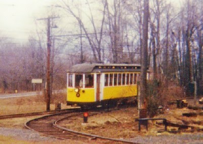
The Connecticut Trolley Museum is the oldest museum dedicated to electric railroading in the US. The 17-acre site in East Windsor, Connecticut operates a mile and a half railway where visitors can take rides on running trolley cars. There are several trolleys and locomotives and railroad equipment among the museum’s displays.

You can ride the Rio de Janeiro Tramways car, the Montreal Tramways cars, or a streetcar from New Orleans, and try to imagine how this mode of transportation affected, and created, the realities of daily life so many decades ago.


From roughly 1890 to 1945, trolleys were a mainstay of public transportation not only within urban areas, but connecting cities. New England towns and cities were once connected with an extensive web of trolley lines. A lot were lost in the Hurricane of 1938, and many other routes were discontinued and tracks pried up during World War II.

For more info, visit the Connecticut Trolley Museum’s website.

Been there? Done that? Bought the T-shirt? Let us know.

Tuesday, October 9, 2007

Mt. Holyoke Summit House


Many of New England’s historic sites and attractions are seasonal, and this time of year traditionally brings them to close. One such venue is the Mt. Holyoke Summit House atop Mt. Holyoke in Hadley, Massachusetts.

It is a small mountain, only just over 900 feet, but overlooking the broad terrain of the Pioneer Valley, the perspective is panoramic. This month the Summit House will close for another year.

A summit house was first built in the 1820s, and went through various owners and renovations to become by the 1850s, quite the stop for well-to-do tourists. An early visitor in 1823 was Ralph Waldo Emerson. A tram was built up the mountain to bring visitors, along with stage coaches up the winding road. Eventually the Summit House boasted upper levels, extensions, elegant dining rooms, and such architectural embellishment that even President William McKinley could not resist its charms, and visited in June of 1898, whereupon he headed down the mountain to attend the graduation of his niece from Mount Holyoke College.

The Hurricane of 1938 tore up a chunk of the building, (Was there nothing that mammoth storm did not touch?) and the Summit House entered its declining years. Deteriorating over the next several decades, supporters kept the building from being demolished and a restoration project in the 1970s and early 1980s gave the Summit House back to Western Massachusetts. From its cozy height, you can see the patchwork farms and the winding Connecticut River, and other companionable mountain ranges that makes the view from the Summit House veranda one of the most easily accessible of lofty inspirations.

Want to go? Now part of the Joseph A. Skinner State Park, have a look at this website for more info.

Been there? Done that? Bought the T-Shirt? Let us know.

Friday, September 7, 2007

Historical Roadside Markers - Western Mass.


A certain breed of tourist reads every historical marker, no matter which side of the highway it’s on or how fast the car is moving. If the rest of the family is patient, mileposts in time as well as distance are reached, but in western Massachusetts, getting there from here can become more ominous with each sign.

One stretch of road in Deerfield is a preserved slice of the Colonial frontier that reminds us what miserable times the colonists had, according to the road signs.

This sign notes a bloody Indian attack in 1675. That sign over there tells of a 1704 attack. That other sign says you can’t park here. Clearly, the settlers had a lot to contend with.

There are more signs, carved monuments and historical marker verbiage on that one lonely stretch of street than in many more miles of rambling Bay State roadside, and that is saying something because Massachusetts is well marked. Most of the signs are not historical markers so much as they seem to be warnings of what can happen to you if you stand in the wrong place.

On a silent, absolutely empty country road in North New Salem there is a chunk of rock on which is carved “Oct. 25th 1777. 1000 Hessians Who Surrendered At Saratoga Passed Here.” There is no other explanation, no name of some long dead historical commission who might have put the stone here. It is almost as if one of the even longer-dead Hessians, bored and mischievous, carved the message himself, like “Kilroy Was Here.”
A completely different scene awaits in Springfield. Another marker to the Revolution stands in tribute to General Henry Knox on a steep knoll by the former Springfield Armory, and a bus stop. In this urban downtown, there is of course no parking allowed in front of the curb where the marker stands. It is a challenge to those compelled by some force unknown to read everything. Risk a ten-car pileup by trying to park illegally, or just hang Junior out the window with the camera as you drive by and read the picture of the monument later? Tough choice.

Luckily, for those fans of the Knox Trail (which probably do not include any of those weary, mud-soaked band who had to drag cannon from Fort Ticonderoga in New York overland across the Bay State to where the bays actually are and thus remove the British from Boston) there is another marker further eastward on the Knox Trail on the West Brookfield/Warren town line. There is no risk of city traffic here, only of being spotted by the Neighborhood Watch.

In Westfield, the town common is graced by a brownstone mile marker from about 1800. It bears the legend: “IX Miles to Springfield Court House.”

Unfortunately, this is not where the marker originally stood. It had been in another part of Westfield at one time and was moved to the common, perhaps so all the monuments could keep each other company. The courthouse in Springfield has also been moved, many times. So, the marker really marks nothing. This one is nothing but a brownstone lie.

These markers would seem to illustrate that old New England joke about telling a traveler “you can’t get there from here.” Sometimes you really can’t, not without imminent danger of being lost because the mile marker is wrong, or kidnapped by enemies of the King, or flattened by some DAR road crew with more historical markers and fresh cement.

For lack of a good frontier war, some Massachusetts towns take to marking sites of famous weather incidents. A typical sign is a reminder of the epic Hurricane of 1938 which greets the traveler over Muddy Brook in the town of Ware. It shows you how deep underwater you would be if you were stupid enough to stand there on September 22, 1938.

Perhaps the ultimate in weather markers stands on Route 47 in the Connecticut River Valley town of Hadley. Here, the water levels of several floods are labeled like a kind of meteorological totem pole. About waist high a sign on this pole marks a 1984 flood, around your shoulders is a sign that marks the November 1927 flood. Above your head the next sign marks the Hurricane of 1938 level, and above that, a sign that must explain how tired the people living here are of hearing the same questions: “No, stopped one inch from first floor. Yes, 5½ feet deep in my living room.” On the very top, perhaps some ten feet above you is the last sign, it marks the March 1936 flood. After reading all these, you almost feel as if you are drowning yourself.

But some fanatical historical marker readers will inevitably admire the totem pole, take a picture, and have another one taken of themselves standing next to it. And then drive on to look for more.

Been there? Done that? Bought the T-shirt? Let us know.

Now Available